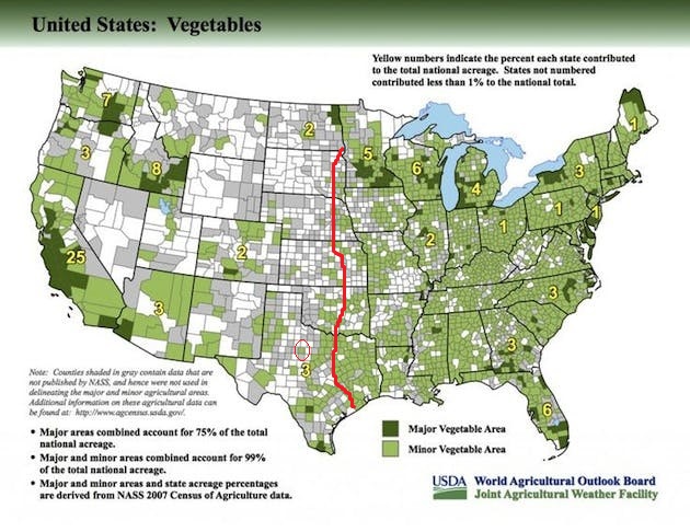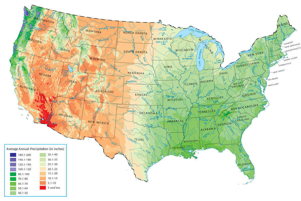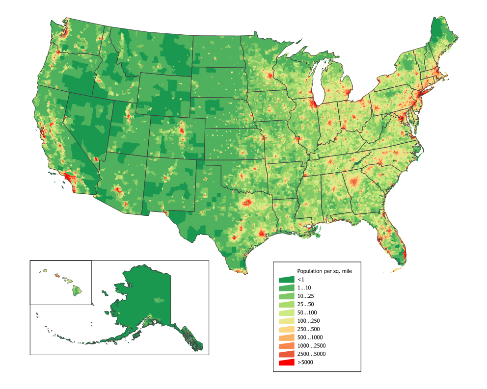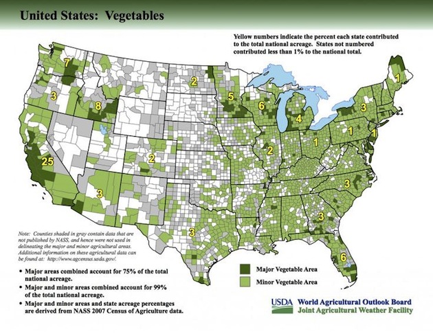
My preference is to be in an area that is still amenable to growing vegetables, but also where the population density has thinned out considerably. That's approximately near the red line below as precipitation also thins out moving west. So these areas aren't "best" for growing but still generally "OK". What the map doesn't show is how much irrigation is being used to help an area become a major or minor vegetable growing area or what specifically is being grown. Jones County, Texas (red circle) is shown as a minor vegetable growing area. I don't know much more than what's on this map and in that thread, but can imagine that mainly what they are doing there is growing cotton and maybe a few select other things with irrigation. Texas A&M confirms that: "The size of the county is roughly 937 square miles, with agriculture being the primary industry. Agricultural production includes cotton, wheat, grain sorghum, hay, and cattle." https://jones.agrilife.org/ Overall I don't think someone is going to get too much past that red line (approximately) moving west and have an easy time of it growing vegetables until it gets wetter near the west coast. And on the line it's not going to be real easy but I've seen it done in Nebraska. I grew up in upstate New York in the dark green area and did real well there. Even kids can do it there. We'll see how it goes in Texas. It'll be a year before I have any results.